
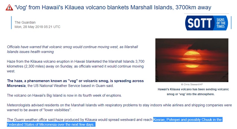
 Sulfur Dioxide (SO2) has now spread 3500 miles west to Micronesia, termed "vog" residents in the Marshall Islands warned to stay indoors, ships and ports bracing for poor visibility. Micronesia which brings me to NAN MADOL a megalithic structure with 80 buildings that used 400,000 stones over 10 tons each to create the walls, and the foundation stones are 100 tons. Problem is that it's partially under water, 100+ feet underwater, constructed on a foundation. Sea levels were at this depth 8000+ years ago.
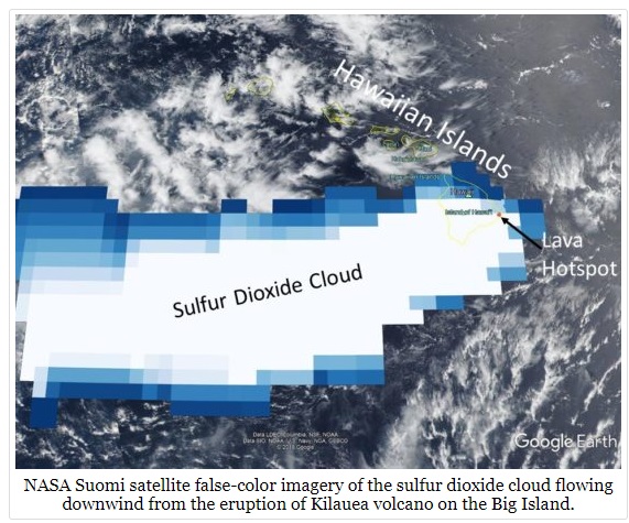
Sulfur Dioxide Spreads from Kilauea to Micronesia's Ancient Megalithic City
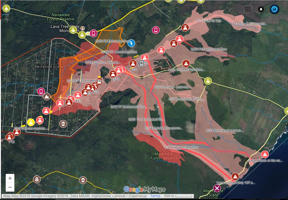
I've included the links to the Kilauea Eruption interactive map, so you can keep up with where the fissures are, and where the rivers of lava flowing into the ocean. These rivers are actually flowing as fast as river water is, it's amazing the change in the composition of the lava the magma wherever it's extruding from. And a couple more breakthrough points that shall be added to number 25 and 26 on this list here.
The reason I bring that up is because it's a never-ending eruption at the moment and is now responsible for health alerts clear over in Micronesia. That's approximately 3,000 miles west of the islands.
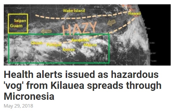
They're calling it a VOG or volcanic smog, residents on the Marshall Islands are being hit first they're warned to stay indoors with lower visibility for shipping. Then all the way over to Guam, Kosrae, Pohnpei, and Truck. This is all in Federated States of Micronesia, it's a US Protectorate, bBut we're looking at least at 3,000 miles west.
Yesterday's video talked about the sulfur dioxide cloud. I also left interactive links below to the NASA site for that with the Swami satellite.
Taking a look at the map here, scuba diving fans you absolutely know where this is, Truck Lagoon has some of the best shipwreck diving from World War two anywhere on the planet. This was a major battle area between US and Japanese forces. Yap is where they have the giant stone money, Palau that's the freshwater jellyfish area with some of the best visibility on the planet, drift diving, this is the absolute gem on the planet still to go scuba diving.
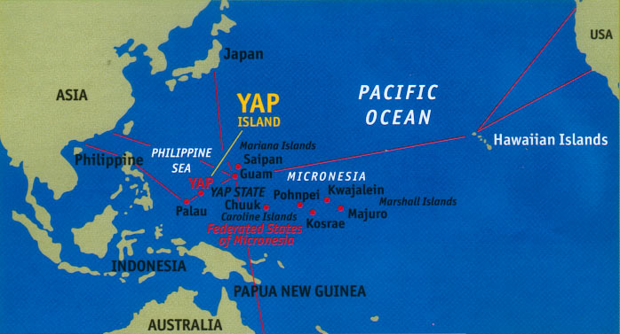
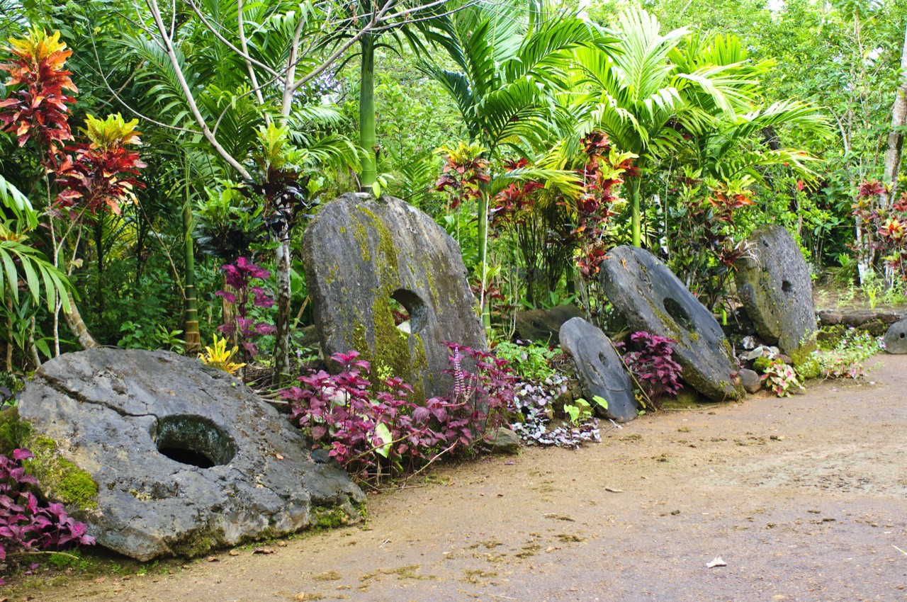
Yap has these giant stones circle money that was rolled from family to family. This was utilized absolutely as a medium of exchange in their island kingdom.
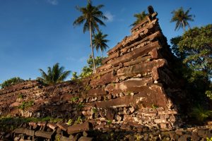
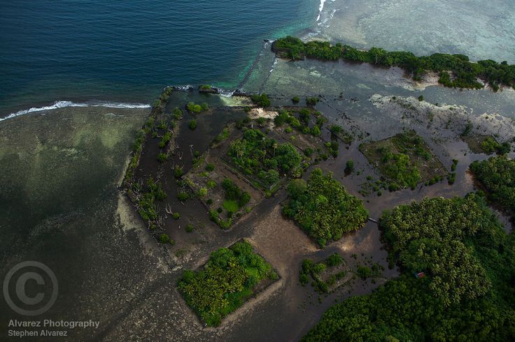
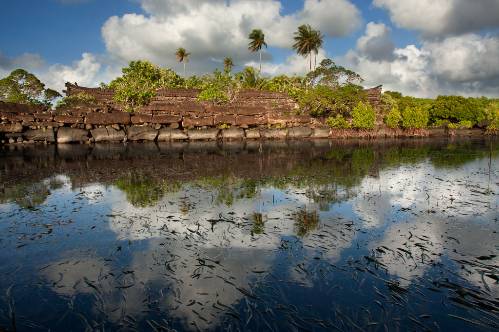
Classic historians give them no credit for being advanced in any way shape or form, just a bunch of Islanders living in bamboo and coconut shacks. Then there’s Nan Madol. This goes right into everything with his cycles of the Grand Solar Minimum, the cycles of our society and the cycles of our history. I want you to take a good look at this, this was built with megalithic stone blocks on a foundation.
Now supposedly with the classic historians, they say that well this was built in 1100 to 1200 AD, approximately 800 years ago.
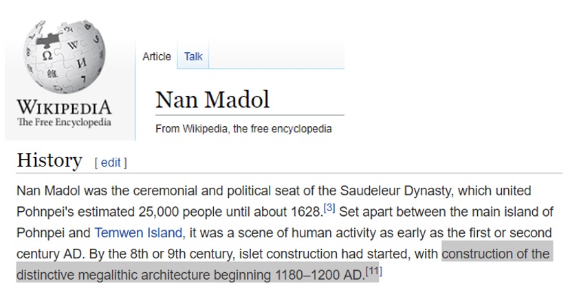
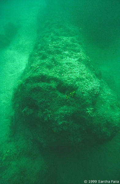
When we just look at the weathering of the base stones themselves, these megalithic blocks. Look at the weathering on that, and you have to think 800 years ago, they would have not built right here because it's too close to the sea.
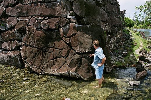
Wide out here so you can see the approximate height of the walls, these basaltic pillars, some of those are 70 tons, 30 feet long. How would they even be able to move such objects around the island, and why would they put it so far out and utilize so many resources to put this thing together?
When you look at the very base of it, those stones are very different than what the walls are created from.
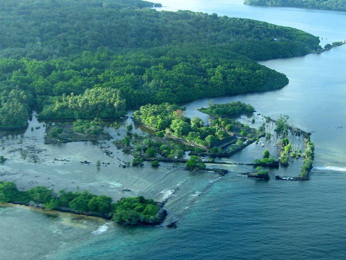
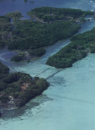
From aerial views, you can also see that these atolls were interconnected as well. If sea levels were approximately the same as today, they were sure not building this, we have to look back in previous times. Bringing you back to scuba diving and snorkeling, you could take tours out to this place, although the cultural ministry is really limiting where you can go and take photos because they're starting to put two and two together, that a lot of researchers are going out there trying to look at these megalithic stones. What they are finding is in some of the deepest areas of the sunken city are 200 ton boulders 213 feet underwater with the stone foundations.
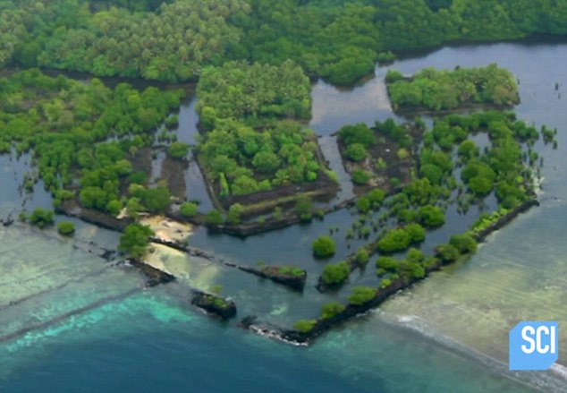
These are some of the pillars that are only in about 30 feet of water,
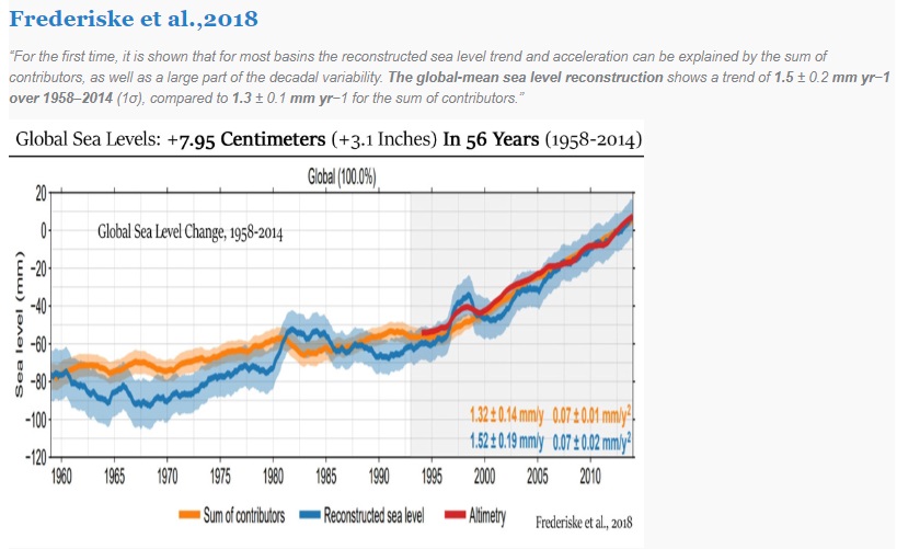
If we're going to believe the classical historians, we have to take a look at sea level back then at 1180 AD, right in the middle of the chart were it says global sea level. You can see from that point forward, sea levels have dropped especially through the Little Ice Age maunder minimum because the glaciers were growing so there was less water, more of it was locked up in glacial ice more of it was up in the poles.
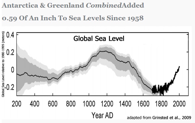
Even if we look at today what the IPCC says, global sea level rise since 1960 has only been three inches in 60 years. If we do the math and we take it out a hundred years, times ten, what's that thirty inches, just under three feet. That is not going to inundate those megalithic stone blocks.
Another aerial view here for you, can really see the complexity of this, and how it rises.
I'm talking about the area that was 200 feet underwater, we have to go to the far right, where it says reef you see that circular enclosure there, that's the area that's down deeper. They think it's an amphitheater of some sort, but again you're forbidden to dive on this exact spot.
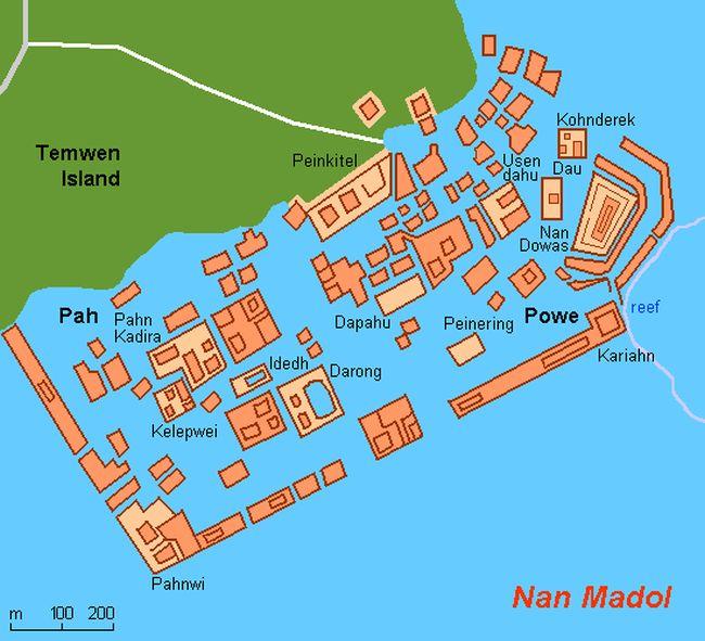
Don't know why other areas right at coastal, you're allowed to dive on you're a lot of snorkel. But when it gets out to the periphery of the foundations of the enclosure itself you're forbidden from going out there. They cited as currents and deep water. I don't know you can snorkel right there and you can exactly see where some of these basaltic rocks are.
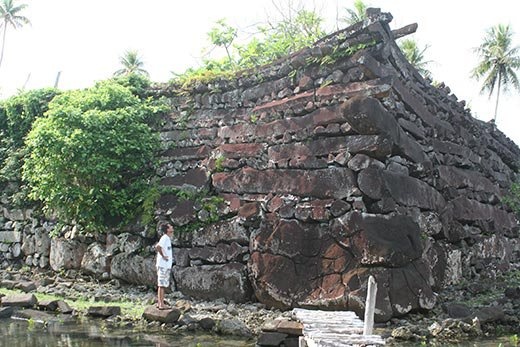
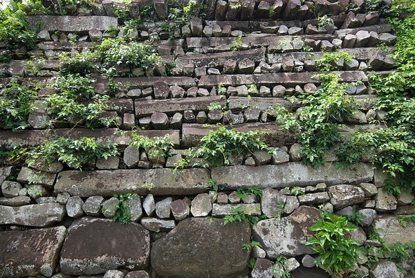
Let's take a look at the different types of foundational stones compared to what the wall building stones are. Those are in the hundred ton range for these boulders, megalithic blocks on the bottom foundation there. Even when you're looking at what these longer pieces are, they call them the pillars, those things are 30 feet long and in in the 50 to 60 tone range. We're told that it's a bunch of people living on an island using coconut shacks and they're building something like this, does not add up at all.
Even if we want to use the sea level change from 1900 to 2010, we're talking about a hundred years of sea-level change. I'll even take you ready to the middle I'm going to be the devil's advocate I'm going to go with three millimeters per year.

We match that out, that's a tenth of an inch. So every ten years that's going to be an inch.

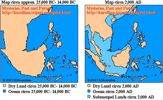
We really have to do is start looking back in history and saying wait a second. This goes right back into the cycles that I'm always studying with this Grand Solar Minimum. If we're going to be looking at foundational structures at that point, where they're located currently at Nan Madol. We really need to go at least eight thousand years back into the past where sea levels would be sixty feet lower.
Traditional history tells us globally there was no evolution to this complexity of architecture, mathematics, and construction methods at that point 8000 years ago. We're talking about hundred ton blocks, moving to the most remote part of the island. The only plausible explanation is that during the last ice age sea levels were far lower than they are today. You can see different continental formations, and we're starting to find cities across the planet that are out in the continental shelves that are now flooded. This makes the most sense that there was a prior culture, we keep reading about this and all the traditions.
PDF of this Article Sulfur Dioxide Spreads from Kilauea to Micronesia's Ancient Megalithic City
FULL VIDEO Sulfur Dioxide Spreads from Kilauea to Micronesia's Ancient Megalithic City
Join ADAPT 2030 NEWSLETTER https://www.oilseedcrops.org
***Mini Ice Age Conversations Podcast***
- iTunes: https://itunes.apple.com/us/podcast/adapt2030
- Soundcloud: https://soundcloud.com/adapt-2030
- Libsyn: http://adapt2030.libsyn.com/
- BitChute: https://www.bitchute.com/hashtag/adapt2030
- Brighteon: https://www.brighteon.com/channel/adapt2030
- YouTube: https://www.youtube.com/user/MyanmarLiving
- Keep ADAPT 2030 independent: paypal.me/adapt2030
- Patreon: https://www.patreon.com/adapt2030
- Steemit: https://steemit.com/@adapt2030
- Medium: https://medium.com/@globalcooling
- FB: https://www.facebook.com/Miniiceage
- Twitter: https://twitter.com/adapt2030
- GAB: https://gab.ai/adapt2030
- Revolution Radio: Studio A – Thursday Nights – 10 PM to Midnight E.S.T. http://www.Freedomslips.com
- Content Created & Produced by David DuByne https://www.oilseedcrops.org