
 Expect a "Gap" in Arctic ice measurement as ageing satellites are all planned to go down at the same time starting next year. Beyond that strange circumstance, the replacements planned are now on hold as NOAA's newest launch malfunctioned and all other launches are on hold, which include ice mapping satellites for a gap of 4 years, all while Arctic ice begins to recover in cooler water pulses into the Arctic and the Grand Solar Minimum intensifies. Its as if the satellites are being purposefully taken off line so the media and governments of the planet wont have to explain why ice recovered so quickly with such summer thickness.
NOAA Satellites Malfunction as Arctic Ice Increases, Four Year Gap Expected
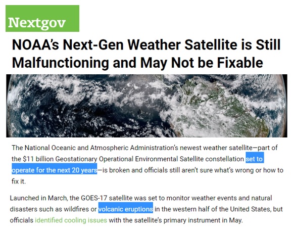
If you hadn't seen the latest news, NOAA's next-generation weather satellite just malfunctioned and it might not be repairable. It was set to operate for 20 years, it was an addition to GOES 17 taking a look at natural disasters wildfires, volcanic eruptions in the western half of the United States. Interesting in the Grand Solar Minimum intensification the launching to study volcanic eruptions. The Cascadia range hasn’t gone into multiple eruptions for hundreds of years yet they're going to send a satellite up to specifically to study eruptions.
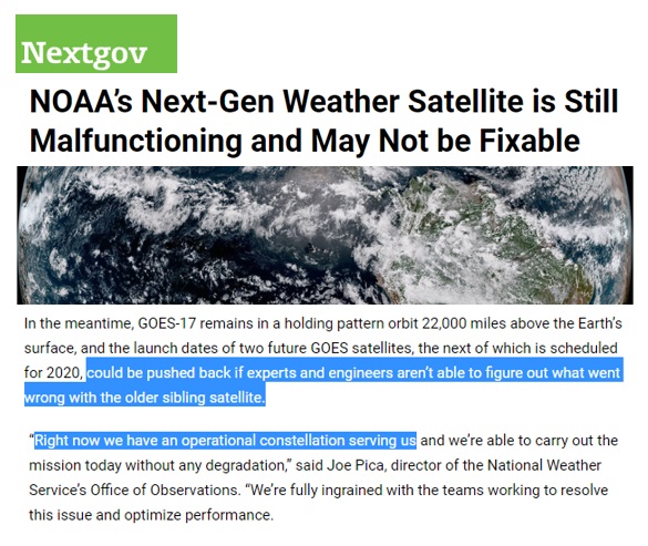
Agencies are also saying the launch of these next set of satellites, could be pushed back if experts can't figure out how to fix what's been going wrong. They're not going to send up any other satellites if they don't know what went wrong with the first ones, because it's going to have the same malfunction as all the components and parts are built by the same companies so the story goes. They tell you and assure you right now we have an Operational Constellation serving us now with weather predictions etc., but it falls right in line with all the Arctic Ice Mapping that we're “used to getting”.
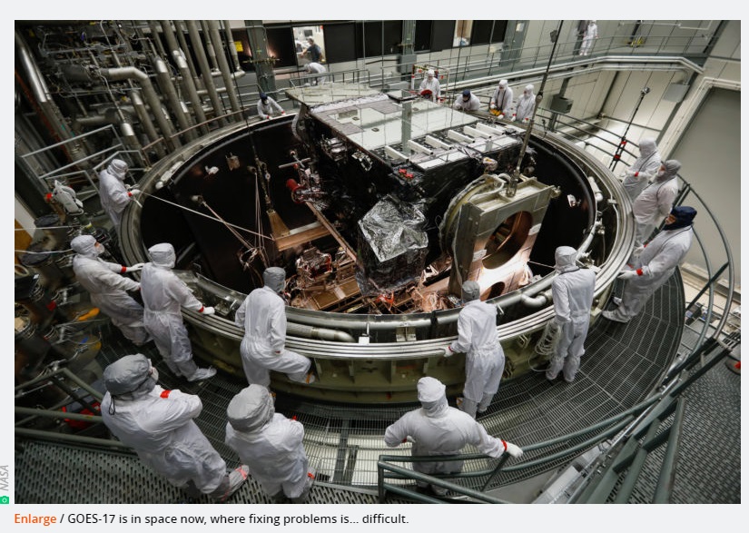
This is GOES 17 under construction.
What did it mean by gaps? Looking into Seeing Ice, these four satellites used to maintain a key record of Arctic and Antarctic sea ice. They're also giving data for weather forecasting across the Arctic maintained by the US military services in some instances here like NSIDC which I'll show you in a second. US Department of Defense, that's the purple, so three out of four of those, and notice even though it's not just US satellites which are ageing, the Japanese satellite data set also is going to break at 2019 to 2021.
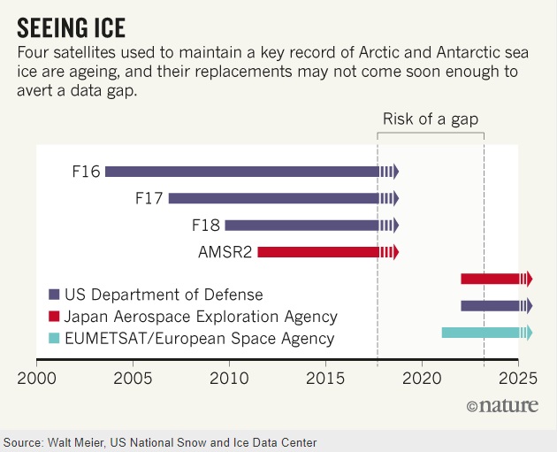
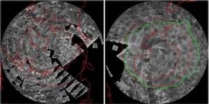
This is incredibly interesting on the timing, because they're telling you in advance that this whole ice satellite data set is going to be interrupted right when ice gains increase to far above the levels we have seen over the last 50 years.
When I mentioned the United States military taking care of some of the ice measurements, the Defense Meteorological Satellite Program called DMSP. What this means is at least three of these aging satellites are all going to die at the same time, they're not going to have any replacements and the one malfunctioning last week, these agencies have told us they're not going to launch anything else up there until they figure out what's going on.
Interesting in the timing on all of this, next possible replacements they're talking about wouldn't launch until it early 2020s but now they're talking about pushing it further back. So you're going to tell me that we're not going to have ice measurements for four or five years? No satellite coverage for the Arctic or Antarctic.
PDF of this Article NOAA Satellites Malfunction as Arctic Ice Increases, Four Year Gap Expected
FULL VIDEO NOAA Satellites Malfunction as Arctic Ice Increases, Four Year Gap Expected
Join ADAPT 2030 NEWSLETTER https://www.oilseedcrops.org
***Mini Ice Age Conversations Podcast***
- iTunes: https://itunes.apple.com/us/podcast/adapt2030
- Soundcloud: https://soundcloud.com/adapt-2030
- Libsyn: http://adapt2030.libsyn.com/
- BitChute: https://www.bitchute.com/hashtag/adapt2030
- Brighteon: https://www.brighteon.com/channel/adapt2030
- YouTube: https://www.youtube.com/user/MyanmarLiving
- Keep ADAPT 2030 independent: paypal.me/adapt2030
- Patreon: https://www.patreon.com/adapt2030
- Steemit: https://steemit.com/@adapt2030
- Medium: https://medium.com/@globalcooling
- FB: https://www.facebook.com/Miniiceage
- Twitter: https://twitter.com/adapt2030
- GAB: https://gab.ai/adapt2030
- Revolution Radio: Studio A – Thursday Nights – 10 PM to Midnight E.S.T. http://www.Freedomslips.com
- Content Created & Produced by David DuByne https://www.oilseedcrops.org