
 We have that melting polar ice caps will raise the sea levels, although Greenland is gaining record ice at the moment, a new island off of Cape Point exactly where there's an increases in land mass along USA East Coast and those ”sea level rise flood events” are King Tides those come yearly and they have for thousands of years we even projected fifty years into the future.
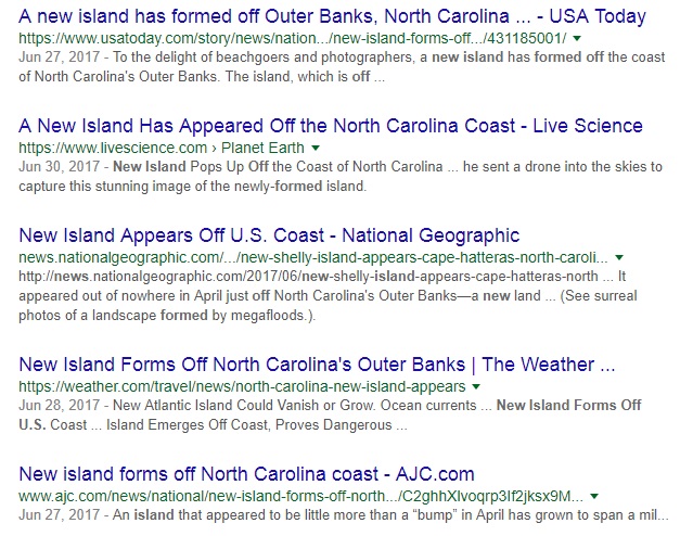
Sea Level Rise Projection Mapping in Jeopardy as New Islands Grow on Western Atlantic Cape
Climate Central Sink in Atlantic coast line meets rapidly rising seas and we have heard again and again how these polar ice caps melting are going to raise the sea level although Greenland's gaining record ice at the moment.
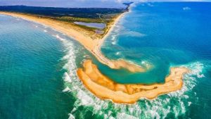
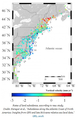
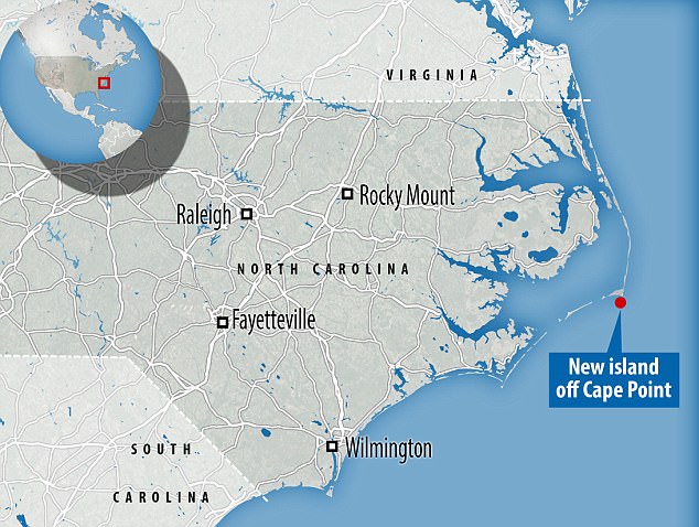
Article from the geophysical research letters has this nice graphic right here anywhere you see blue dark blue that means that supposedly we're being inundated from sea level rise that the land is sinking. Anywhere you see reds the land is uplifting due to push from the crust. Pay close attention to 36 degrees north at demarcation 14 and 15 right at the border of Virginia North Carolina those are called the Outer Banks here's a map of the area Cirrus says new island off of Cape Point.
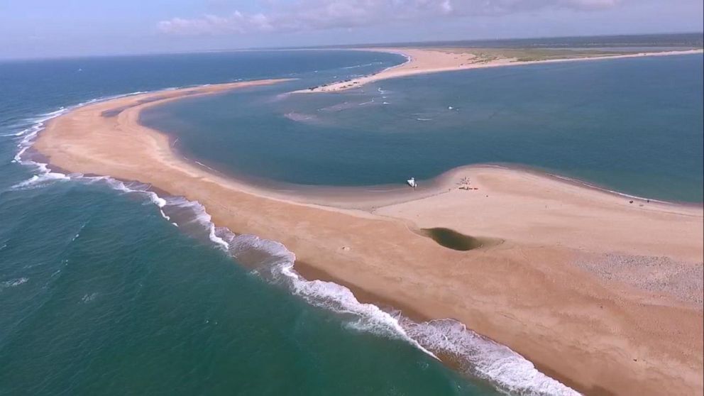
Land is rising out of there this is a new island called Shelly Island huge tourist attraction draw right now for tourists along the Outer Banks. Thousands and thousands of people are going out there to see this new landmass rising from the sea. I thought it was supposed to be sinking out there, but anyway don't ask questions, sea levels are rising, don't worry about it.
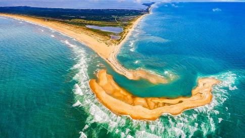
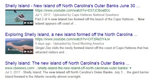
They named it Shelly Island it's off to North Carolina's Outer Banks this just happened last month this is not a small land mass and it does keep growing. Of course AGW proponents response is; well it won't last very long it's just a huge sandbar that's sort of growing at the moment, but don't worry the next time there's big waves it'll go away and we don't have to even think about that doesn't fit the model anymore so just don't ask questions, it'll disappear someday.
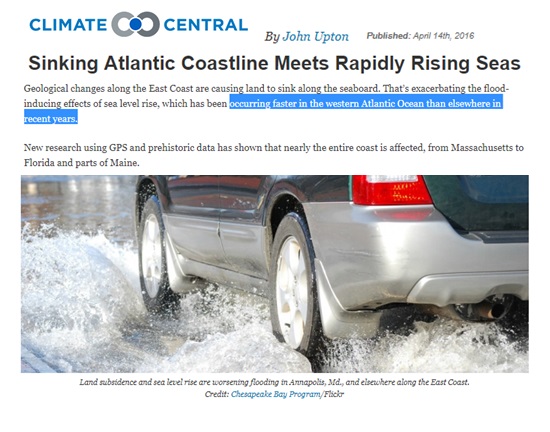
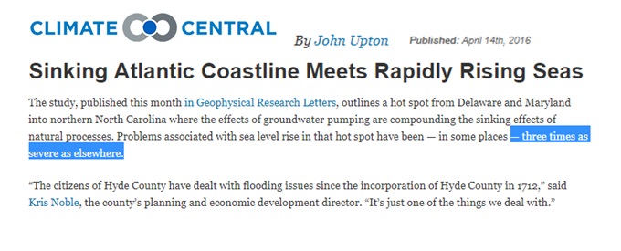
The article continues that this rising sea level is occurring in the western Atlantic which is the that exact same coastline in East Coast United States faster than anywhere else three times faster as a matter of fact and they even show this picture of a car driving through water from this tide that swept over our beaches. What they negate to tell you that it was a king tide and this happens every single year. It's happened for hundreds of years it's the highest tide of the year the king tide.
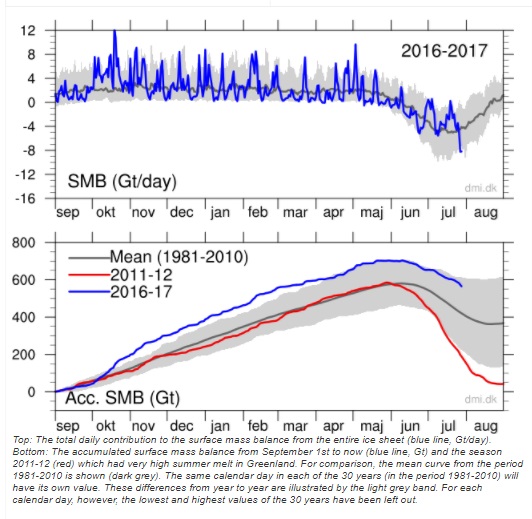
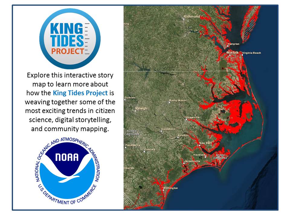
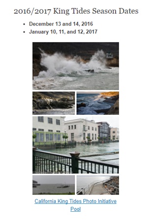
Sometimes when there's a storm or wind it'll actually push the water a little further inland. Here are some images of the 2016-17 King Tide we know exactly when these are going to happen 50-70-100 years into the future and the IPCC acts like it's some sea level rise event, when it's just the highest tide of the year.
Talk about misconstruing the information for a political agenda.
If you do happen to visit this island please send me a note I'd love to see the pictures and get your account of what was really going on out there and how much the island has grown since these images were captured.
Video and Content Produced by David DuByne
YouTube Channel ADAPT 2030
ADAPT 2030 Channel on YouTube | Mini Ice Age 2015-2035
PODCAST SHOW EPISODES of MINI ICE AGE CONVERSATIONS
Mini Ice Age Conversations also on Libsyn, iTunes and Soundcloud
Sea Level Rise Projection Mapping in Jeopardy as New Islands Grow on Western Atlantic Cape (VIDEO)